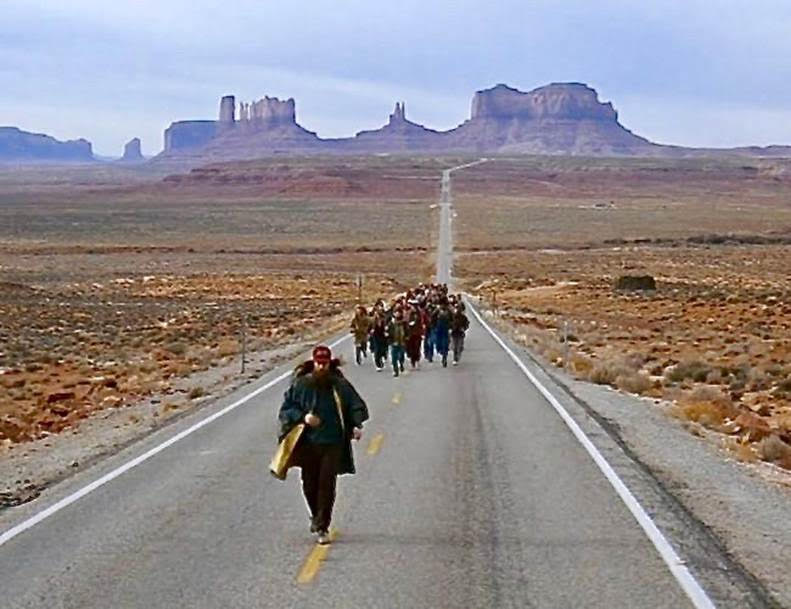
Pop quiz – can you name the significance of the photo posted below? Read on and I will let you know at the end.
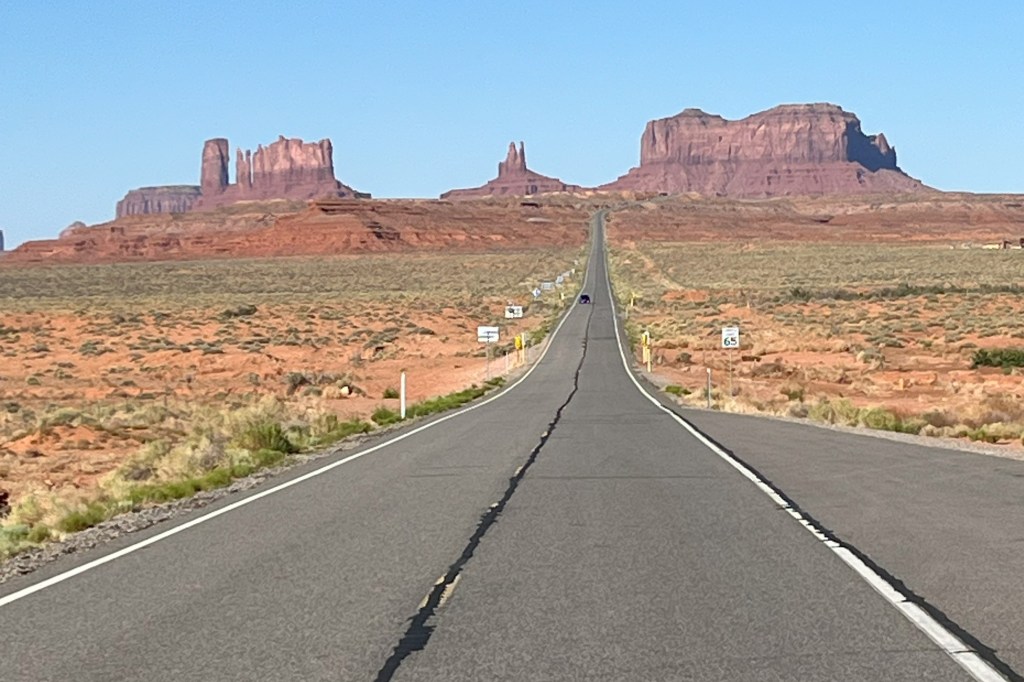
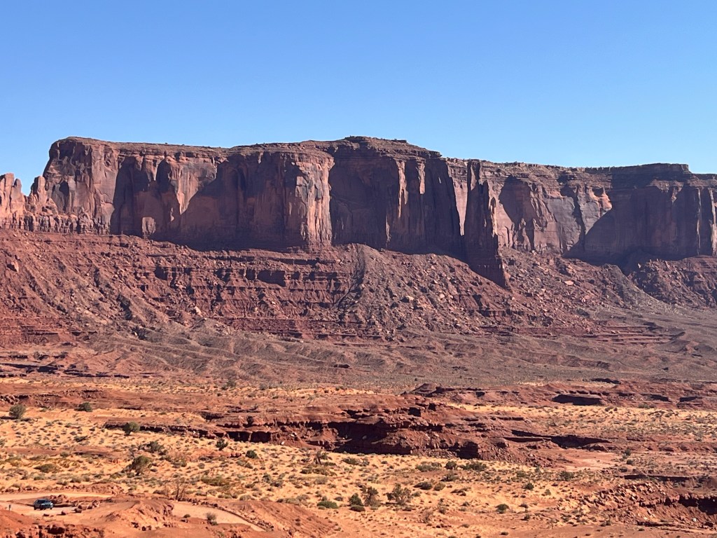
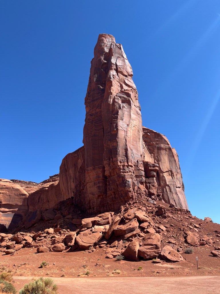
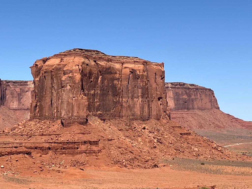
As I headed down U.S. 191 in Utah, I entered the Navajo Nation, which is the largest Indian reservation in the United States, exceeding the size of ten U.S. states, and spanning parts of New Mexico, Utah, and Arizona, with a population of over 165,000. At Bluff, Utah, I turned onto U.S. Highway 163, and took the photo posted above at milepost 13, near Mexican Hat, Utah, before continuing on into Arizona. Just inside the border, the road was designated the Kayenta-Monument Valley Scenic Road in Navajo County. I soon turned off into the Monument Valley Navajo Tribal Park, a Navajo entity equivalent to a U.S. national park, and considered to be sacred land. I took the dogs on a two-mile hike on one of the trails. I then had to unhook the trailer in the parking lot so that I could drive the 17-mile loop within the park and view the magnificent buttes. The road was extremely bumpy and very hard on brakes, tires and suspensions. But overall, the park was, well, monumental.
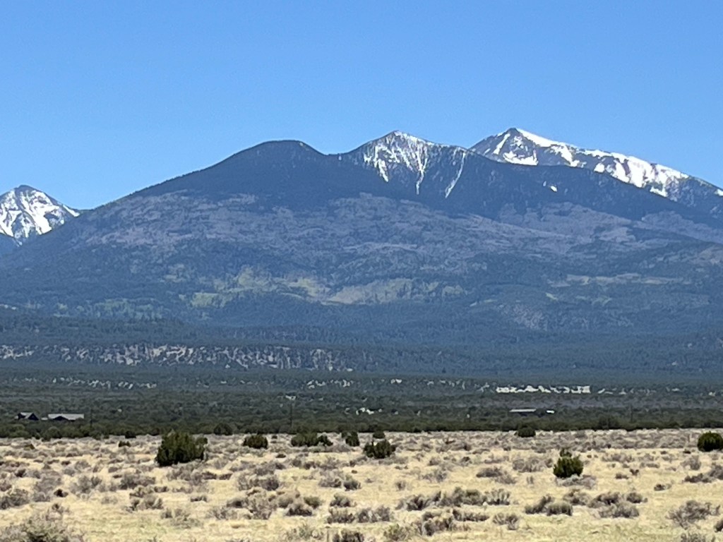
From there I headed further south and turned onto U.S. Highway 89 towards Flagstaff and Sedona. A portion of that highway is designated the Navajo Code Talkers Highway, honoring the Navajo code talkers who served in World War II (similar to members of other tribes that I saw so honored in Oklahoma). Also on 89, I passed the San Francisco Peaks, which includes Humphreys Peak, the highest point in the state of Arizona.
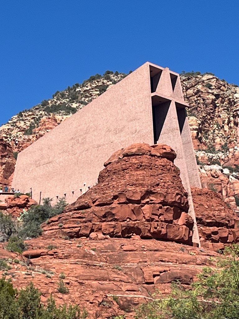
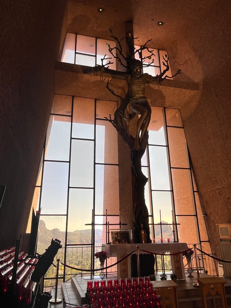
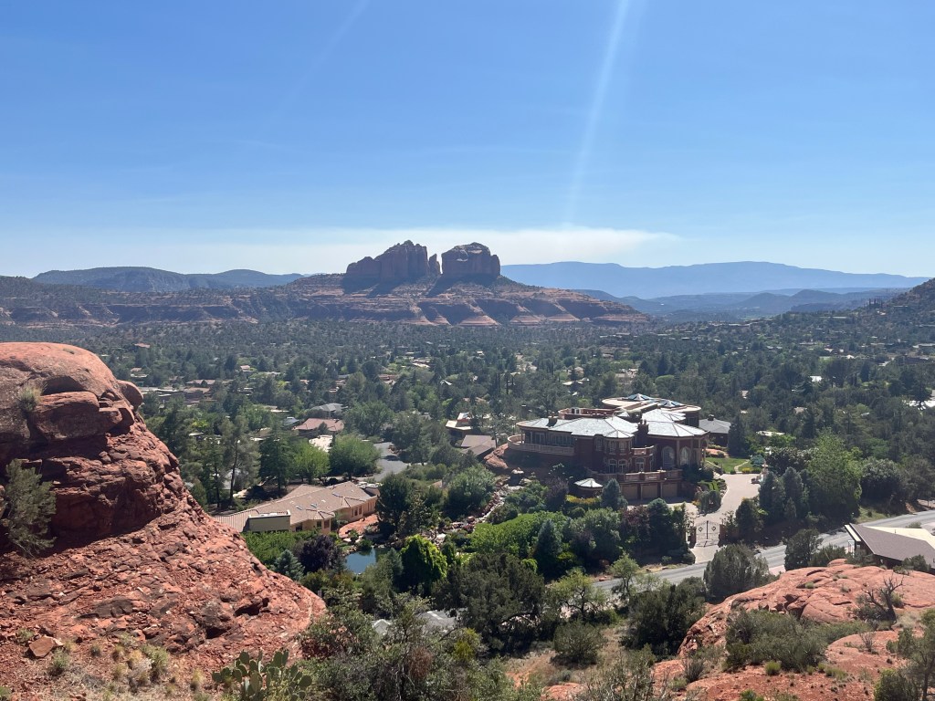
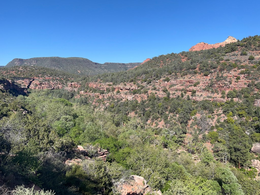
I drove through the Coconino National Forest along Oak Creek Canyon and then finally arrived in Sedona, Arizona, a beautiful city and apparently the backdrop for many Hollywood movies. I wanted to visit the city to see the Chapel of the Holy Cross which is built on the side of a red rock cliff, and which is included in many lists of the most beautiful churches in America. It did not disappoint.
I then drove back into the Coconino Forest to the Pine Flat Campground alongside the Oak Creek Canyon.
Again, I apologize for posting so many pictures, but there was lot to see on this day. Posted are three photos from Monument Valley, one of the San Francisco Peaks, three from the Chapel of the Holy Cross (one of the outside, one of the altar on the inside, and one looking down on Sedona from outside the church), and a panoramic of the Oak Creek Canyon gorge, near my campsite. Finally, I downloaded a picture that explains the answer to the pop quiz. The spot where I took the photo above has been given the nickname Forrest Gump hill, as it is the spot where Forrest stopped after running for over three years following his mother’s death and Jenny’s departure. In the movie, he abruptly stops and tells his followers, “I’m pretty tired. I think I’ll go home now.”

Leave a comment